

FJ DYNAMICS RANGE · MOBILE LIDAR SCANNER
FJD Trion X1
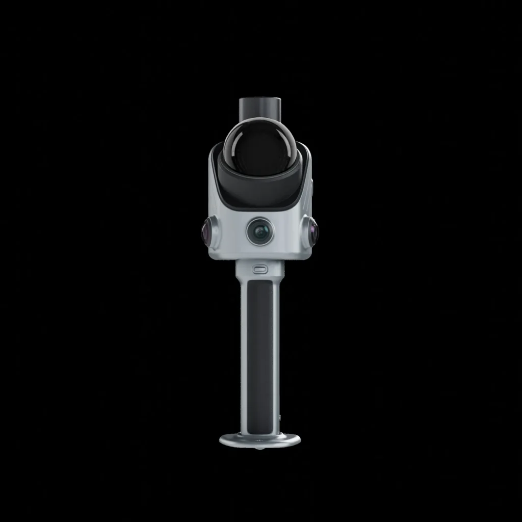
The handheld LiDAR scanner that guides your teams in the field. LiDAR, GNSS, 360° imaging and a built-in screen in a single device: you define the mission, the operator follows it step by step, and the 3D survey comes back annotated, ready for reporting.
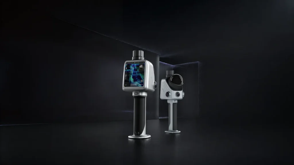
One device for all your field capture
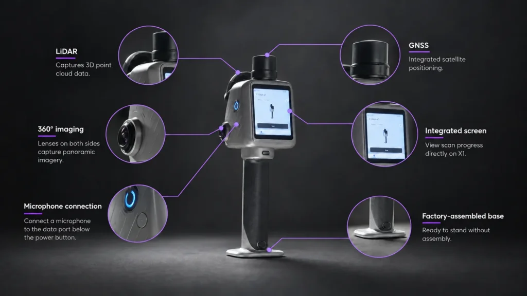
LiDAR 384,000 pts/s
Dense point cloud, relative accuracy ≤ 1 cm after processing.
Built-in GNSS
Satellite positioning to georeference your surveys.
360° imaging
Two 48 MP cameras for complete colour panoramas.
3.9" OLED screen
The operator sees what they are aiming at and what they are capturing, no phone needed.
External microphone
Plug in a microphone to dictate your observations while scanning.
Factory-fitted stand
Ready to set down, ready to scan: no on-site setup.
Start from the mission, not the scan
Sending someone on site is easy. Making sure they bring back the right data is much harder. With the X1, you give your team a precise capture task: the operator receives it on the device and follows the steps through to the final report.
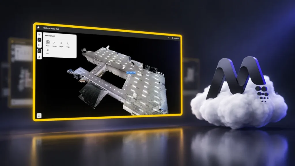
1. Plan the mission from the office
In FJD Trion Model Web, define the area, draw the route and set the priorities. The mission is sent straight to the operator's X1.
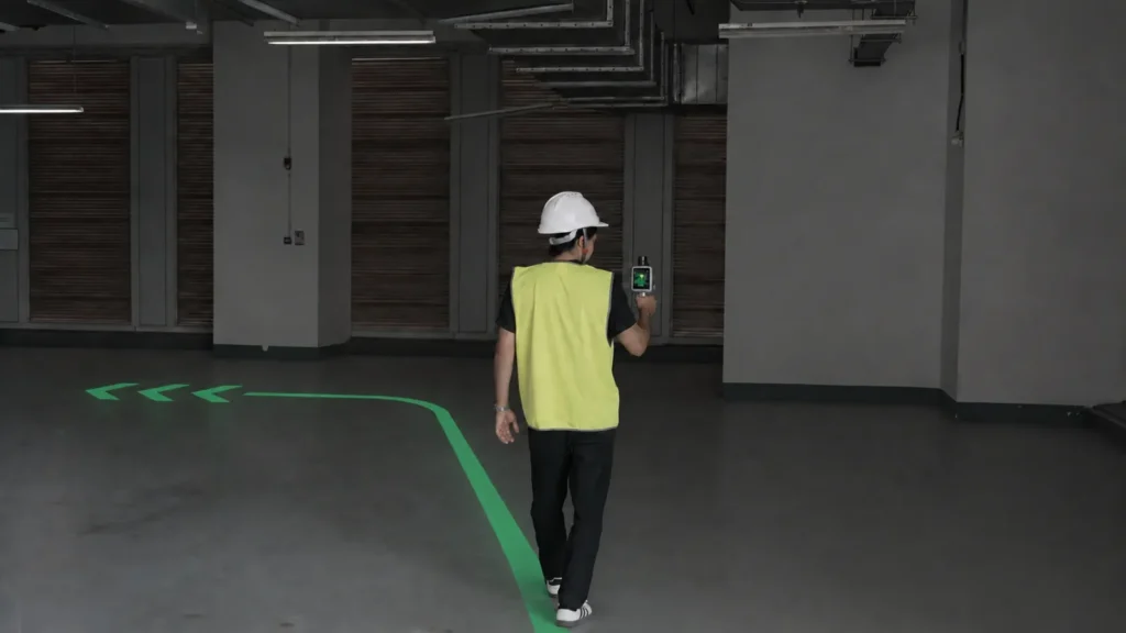
2. Follow the guided route
The operator follows the on-screen route guidance while scanning, capturing exactly what was requested and missing nothing.
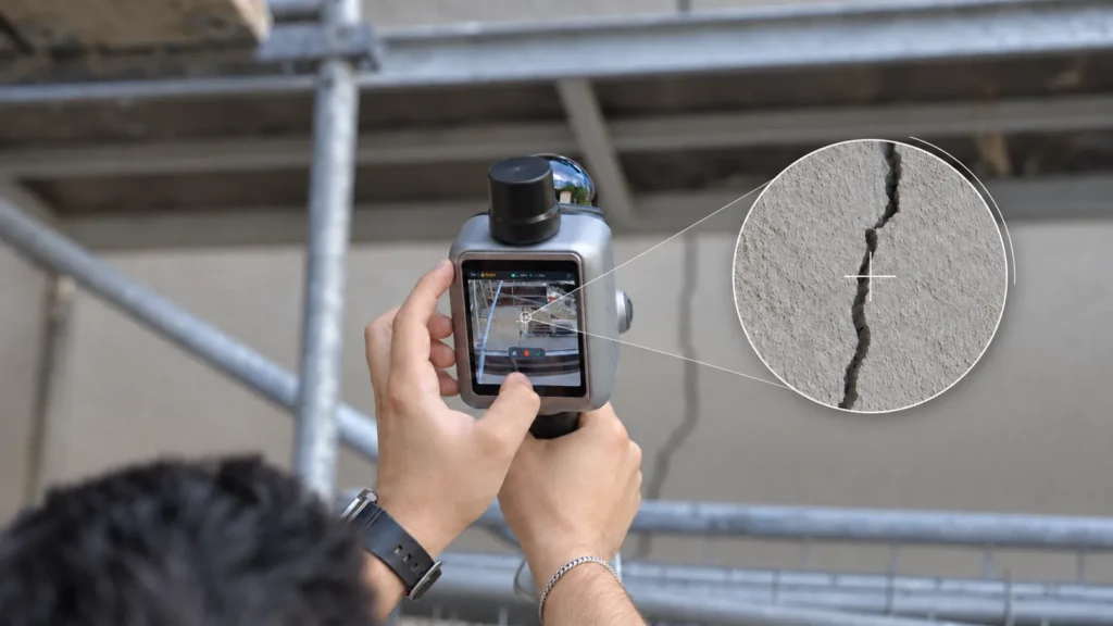
3. Mark issues in 3D
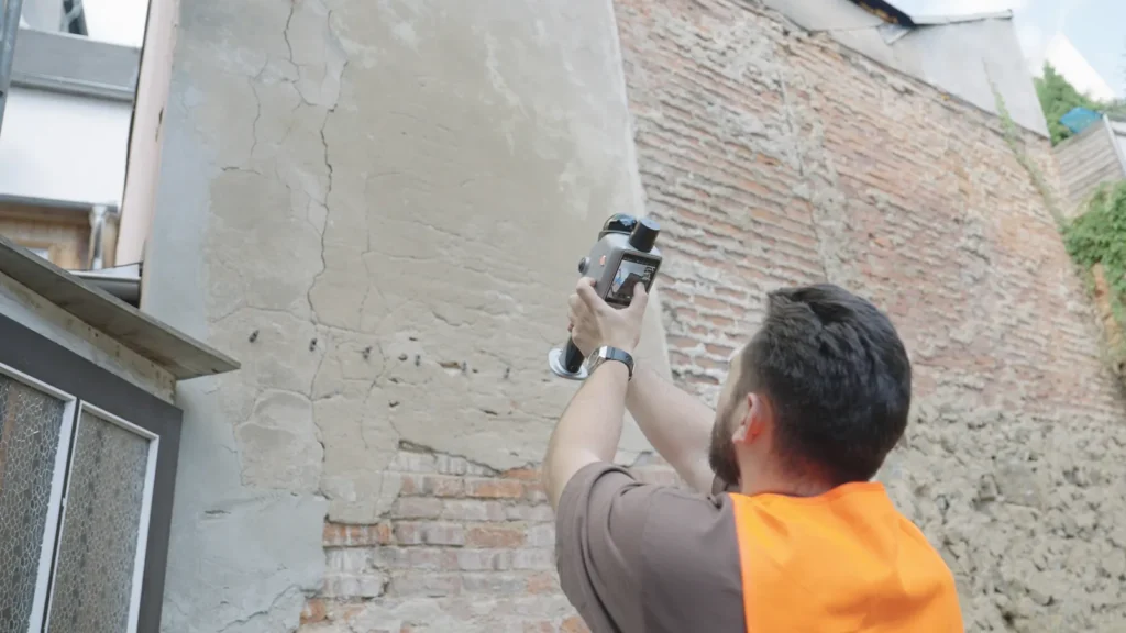
Using the crosshair, each issue (crack, snag, defect) is pinned to its exact position in the 3D survey.
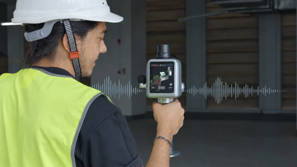
4. Give every finding a voice
Dictate your observations in any language while scanning. Model Web transcribes them for review.
From the field to the report
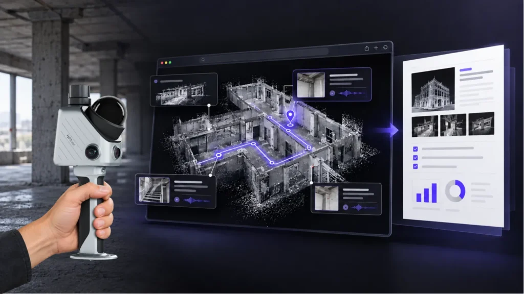
3D survey, route, issue markers and transcriptions all come together in Model Web. You generate a report ready to be reviewed, shared and acted upon.
FJD Trion X1 specifications
LiDAR rate
384,000 points/s
Range
40 m at 10% reflectivity · 70 m at 80%
Accuracy*
Relative ≤ 1 cm · absolute 3 cm (post-processed point cloud)
LiDAR field of view
360° × 62° · Class 1 eye-safe laser
Front camera
80° × 44° · 1280 × 1024
Panoramic camera
360° × 360° · 2 × 48 MP · JPG export
SLAM & resume
Visual SLAM · resume scanning after an interruption
Screen
3.9" OLED · 1280 × 1024
Battery life
Up to 5 h with a set of 2 batteries · ~18 W · 67 W fast charging, dual simultaneous charging
Dimensions & weight
114 × 152 × 329 mm · 900 g (unit) · 1.3 kg (complete kit)
Environment
IP54 · -20 °C to 50 °C operating · -40 °C to 60 °C storage
Data
512 GB, expandable to 1 TB · LAS, PLY, PTS, E57 · Wi-Fi, USB-C, USB stick
* Accuracy measured under laboratory conditions. Actual results depend on the environment, the method and the operating conditions.
Built for high-value projects

Construction & existing-conditions surveys
Construction, renovation, MEP (HVAC, electrical, plumbing) and as-built records.
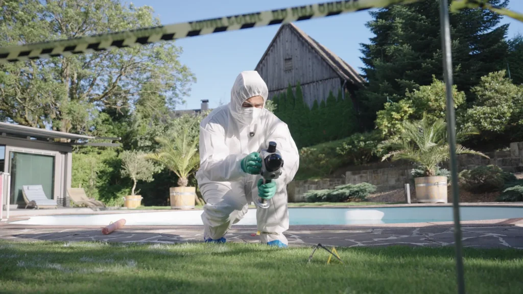
Incident documentation & security
3D surveys and panoramas to document an incident or support an investigation.
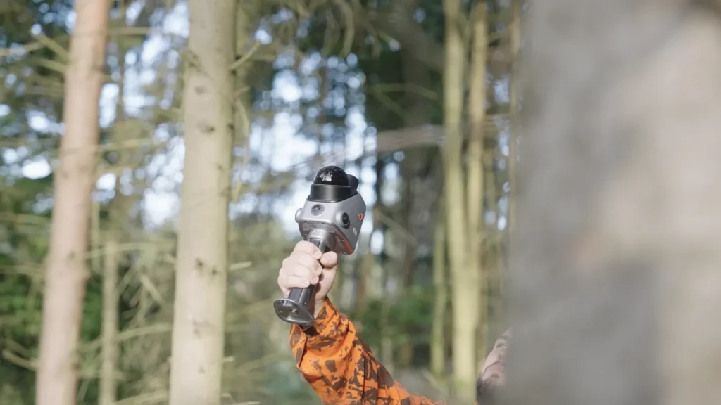
Urban trees & campuses
Tree inventories, campus roads, green spaces and landscaping.
Quarries & stockpiles
Stockpile and material volume calculations, positioned and georeferenced with GNSS.
The X1 with DART Solutions
DART Solutions supports you from demonstration to commissioning: on-site trial, operator training and onboarding on FJD Trion Model Web. To go further, we can work with you on automating surveys with our quadruped robots and our robot control platform.
FJD Trion X1 frequently asked questions
How accurate is the FJD Trion X1?
After post-processing, accuracy is 1 cm or better in relative terms and 3 cm in absolute terms. These values are measured under laboratory conditions: actual results depend on the environment, the survey method and on-site conditions.
Do I need an external GNSS receiver?
No. The X1 has its own built-in GNSS module to position and georeference your surveys. We help you define the right method for your georeferencing requirements.
Which file formats does the X1 export?
Point clouds are exported as LAS, PLY, PTS and E57, and images as JPG. These standard formats open in most surveying, point cloud processing and BIM software. Data is transferred over Wi-Fi, USB-C or a USB stick.
What is the scanner's battery life?
Up to 5 hours with a set of two batteries, at a power draw of around 18 W. The 67 W fast charger charges both batteries at the same time.
Does the X1 work outdoors and in bad weather?
Yes. It is IP54-rated (dust and water splashes) and operates from -20 °C to 50 °C, indoors and outdoors.
Can I see the X1 in a demonstration?
Yes. DART Solutions runs demonstrations at your site and trains your operators on the scanner and on FJD Trion Model Web.
Want to see the X1 in action on your site?
Tell us about your project: existing-conditions surveys, construction progress monitoring, inspection or volume calculations. We will set up a demonstration and help you choose the right configuration.
Contact us