

FJ DYNAMICS RANGE · MOBILE LIDAR SCANNER
FJD Trion S2
The SLAM LiDAR scanner for large sites and difficult terrain. Up to 640,000 points/s and 300 m range, built-in RTK GNSS and 2 × 48 MP cameras: handheld, on a pole, on a vehicle, on a drone or on a quadruped robot.
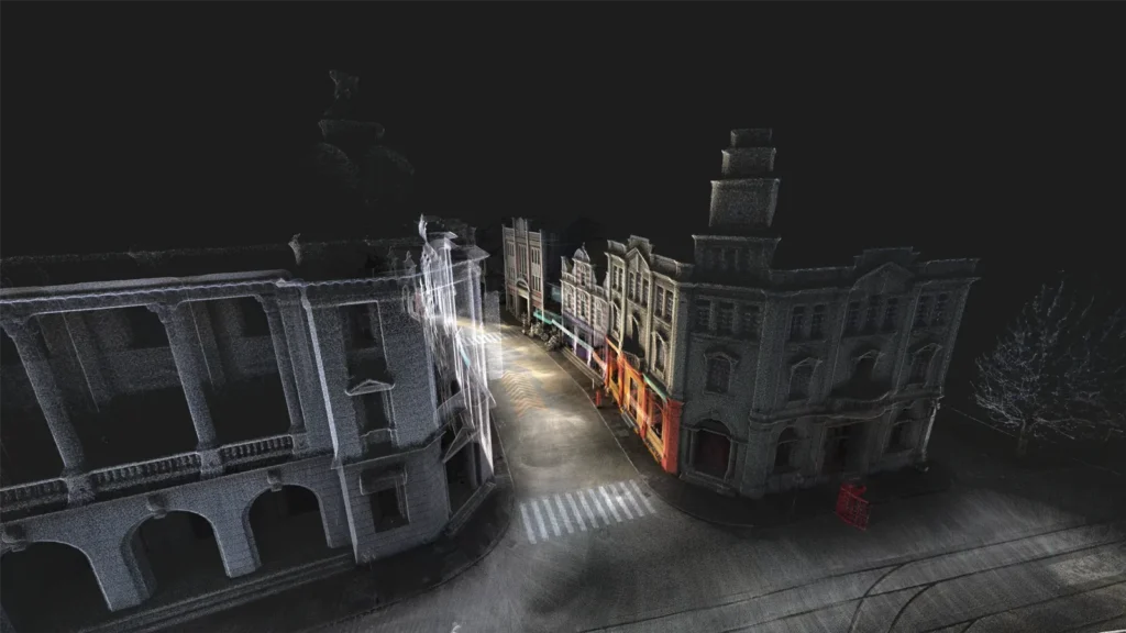
Three versions to match the scale of your project
Choose the right range and density, from detailed surveys to large-area mapping. All three versions share the same housing, cameras, GNSS and software.
FJD Trion S2
Balanced performance for everyday surveys of large sites.
• 16 LiDAR channels
• 320,000 points/s
• 120 m range (80 m at 10% reflectivity)
FJD Trion S2 Pro
Twice the point rate to capture faster and in finer detail.
• 32 LiDAR channels
• 640,000 points/s
• 120 m range (80 m at 10% reflectivity)
FJD Trion S2 Max
Maximum coverage for large open areas.
• 32 LiDAR channels
• 640,000 points/s
• 300 m range (80 m at 10% reflectivity)
Every sensor in one device, ready in seconds
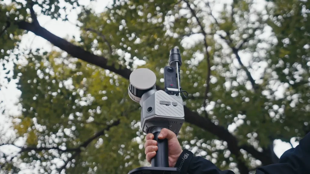
16- or 32-channel LiDAR
360° × 270° field of view, Class 1 eye-safe laser.
Built-in RTK GNSS
Multi-constellation, RTK accuracy of 8 mm + 1 ppm horizontal.
Inertial measurement unit
High-precision IMU for a stable trajectory, even on the move.
2 × 48 MP cameras
Fisheye lenses for colourisation and 306° panoramas.
Consistent quality at scale
Thin, clean point clouds
Point cloud thickness under 1 cm for reliable measurements, even on very large projects.
HyperDense+
In FJD Trion Model, point clouds 5 to 7 times denser, down to 1 mm spacing, for finer surfaces and better colourisation.
Georeferenced from the start
Built-in GNSS and over 8,000 coordinate systems: data drops straight into your GIS and mapping workflows.
The full site context
Colourised point cloud, immersive 3DGS models and panoramic imagery from a single capture.
From ground to air: one scanner, every carrier
Handheld, on a pole, in a backpack, on a vehicle, on a drone or on a robot: the S2 adapts to the terrain to cover roads, infrastructure, forests and complex sites.
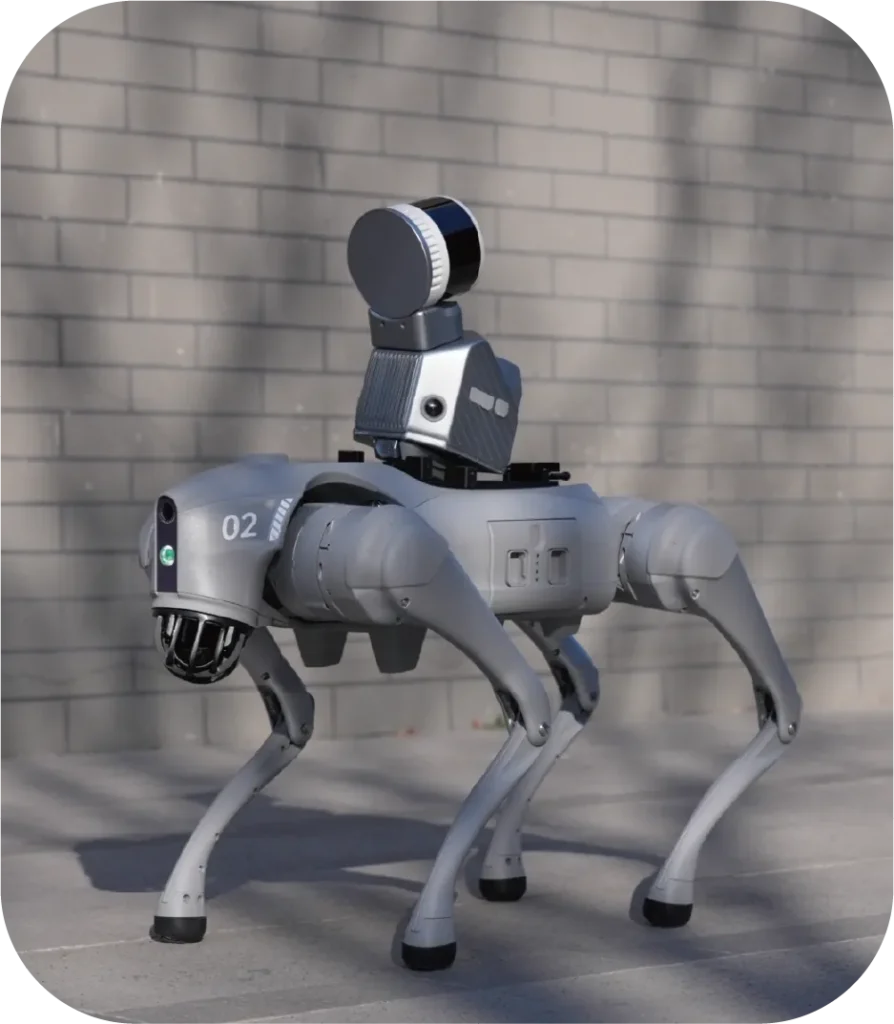
ON A QUADRUPED ROBOT
The S2 on a robot: DART's expertise
FJ Dynamics offers an official quadruped robot mount. This is what we do: DART Solutions integrates the S2 on Unitree robots and controls them from its platform. The robot covers hazardous, confined or repetitive areas (tunnels, industrial sites, active construction sites) while your teams stay safe.
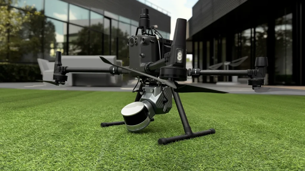
On a drone
Air-to-ground coverage of inaccessible areas, combined with ground surveys.
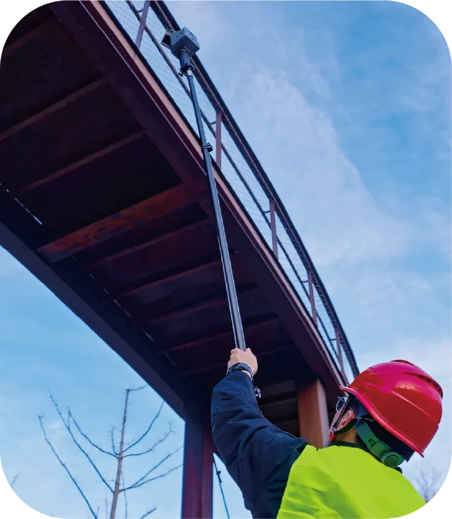
On a pole
Reach high, narrow or overhanging areas: soffits, ducts, roofs.
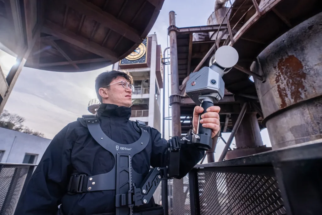
Stabilising vest
Less fatigue on long sessions, with up to 1 hour of continuous scanning.
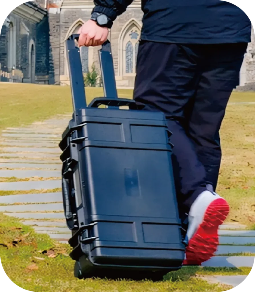
Carry case
A complete, protected kit that is easy to move from site to site.
Large projects, without interruption
Scan for longer
Continuous scan sessions of up to 1 hour to cover large areas in one go.
Pick up where you left off
Survey a site in stages: simply re-align on an area already scanned and the software merges the data with no manual registration.
FJD Trion Model
Full processing on PC: point clouds, meshing, 3DGS, CAD/BIM, cross-sections, forestry analysis.
FJD Trion Model Web
Access, share and deliver projects in the cloud, for review and collaboration across multiple sites.
Model for tablet
Check and process data directly in the field, before leaving the site.
Ready-to-use deliverables
Orthophotos, terrain models, contour lines, volume calculations, cross-sections, plans and progress monitoring.
FJD Trion S2 specifications
Specifications common to all three versions. Range, channel count and point rate vary by version (see above).
LiDAR field of view
360° × 270° · Class 1 laser (905 nm), eye-safe
Accuracy*
Relative ≤ 1 cm · absolute 3 cm
RTK accuracy
H: 8 mm + 1 ppm RMS · V: 15 mm + 1 ppm RMS
GNSS
BDS, GPS, GLONASS, Galileo, QZSS · PPS output
Cameras
2 × 48 MP fisheye · 306° × 235° · JPG export
SLAM
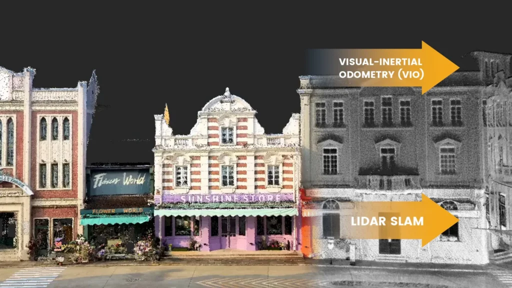
LiDAR SLAM and visual SLAM (visual-inertial odometry)
Battery life
3 h with a set of 2 batteries · 25 W
Power supply
10.8 V, 3 A
Weight & dimensions
1.8 kg (excluding battery, external camera and RTK module) · 107 × 118 × 398 mm (with stand and battery)
Environment
IP54 · -10 °C to 50 °C operating
Storage
512 GB, expandable to 1 TB
Data
LAS, PLY, PTS, E57 · Wi-Fi, USB-C, USB-A
* Accuracy measured in a test environment. Actual results depend on the environment, the method and the operating conditions.
Built for capturing large sites

Construction
BIM workflows, plans, volume calculations and as-built records.

Surveying & mapping
Orthophotos, terrain models, contour lines, cross-sections and progress monitoring.
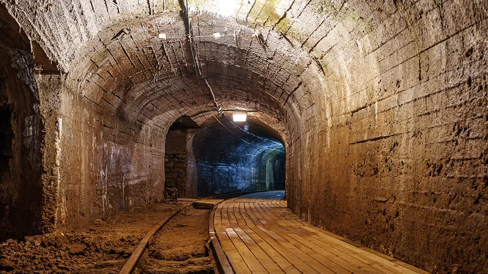
Mines, quarries & tunnels
Volume calculations, cross-sections and progress comparison, even without GNSS signal thanks to SLAM.
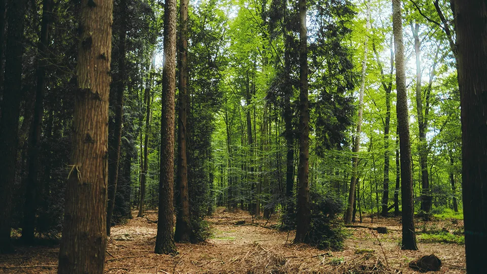
Forests & vegetation
Tree segmentation, crown analysis, species identification and inventories.

Infrastructure & built assets
3D asset models, cross-sections and plans to manage and assess structures and buildings.

Public safety
Fast, complete surveys of disaster-hit or hazardous areas, ideally by robot.
S2 or X1: which FJ Dynamics scanner?
Choose the S2
Large sites, long distances, forests, tunnels, aerial or robotic surveys: range up to 300 m, RTK GNSS and multiple carriers.
Choose the X1
Guided missions and building surveys: the operator follows an on-screen route, marks issues in 3D and dictates notes for a direct report.
Discover the FJD Trion X1 →FJD Trion S2 frequently asked questions
What is the difference between the S2, S2 Pro and S2 Max?
The S2 has 16 LiDAR channels (320,000 points/s, 120 m). The S2 Pro moves up to 32 channels and 640,000 points/s. The S2 Max keeps that rate and extends the range to 300 m for large open areas. The rest of the equipment is identical.
How accurate is the FJD Trion S2?
Relative accuracy of 1 cm or better and absolute accuracy of 3 cm, with RTK positioning of 8 mm + 1 ppm horizontal. These values are measured in a test environment: actual results depend on the site and the method.
Can the S2 be mounted on a robot, a drone or a vehicle?
Yes. FJ Dynamics offers mounts for quadruped robots, drones, vehicles, poles, backpacks and a stabilising vest. DART Solutions specialises in integration on Unitree robots and their remote operation.
Does the S2 work without GNSS, in tunnels or indoors?
Yes. LiDAR and visual SLAM reconstruct the trajectory without satellites. Outdoors, the built-in GNSS georeferences the point cloud directly.
Which formats and software can I use with the data?
Export to LAS, PLY, PTS and E57, with images in JPG. FJD Trion Model (PC, tablet and web) handles processing, deliverable production and sharing; the standard formats also open in most surveying and BIM software.
Can I see the S2 in a demonstration?
Yes. DART Solutions runs demonstrations at your site, handheld or on a robot, and trains your operators.
A large site to survey?
Surveying, construction, mining, forestry or robotic surveys: tell us about your project. We help you choose the right version and carrier, and set up a demonstration.
Contact us