

OFFICIAL EMLID RESELLER
Emlid range · Compact GNSS RTK rover
Emlid Reach RX2
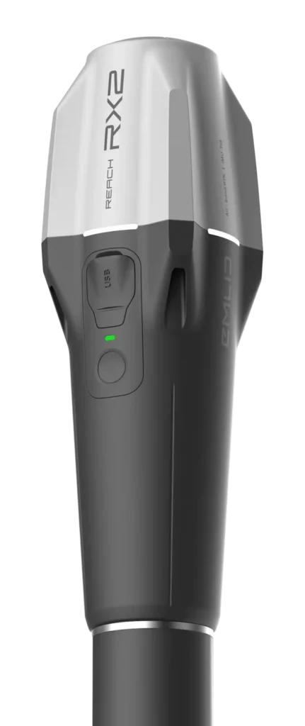
Emlid's compact and lightweight GNSS RTK rover (280 g). It delivers centimetre accuracy with tilt compensation for GIS, utilities and construction. It works with ArcGIS Field Maps, QField and PIX4Dcatch.
From €1,999 excl. VAT · commissioning and training by DART Solutions
280 g
all included
672
multi-band channels
7 mm
+ 1 ppm, horizontal RTK accuracy
16 h
battery life
IP68
immersion 1.5 m, 30 min
Offers and prices
The RX2 on its own, ready on a pole, or equipped for georeferenced 3D scanning.
RECEIVER ONLY
Reach RX2
€1,999 excl. VAT
• 280 g, multi-band
• USB-C cable
• MFi certified for iPhone and iPad
READY ON A POLE
Reach RX2 rover kit
€2,395 excl. VAT
• Reach RX2
• Survey pole with smartphone mount
• Quick release adapter
3D SCANNING
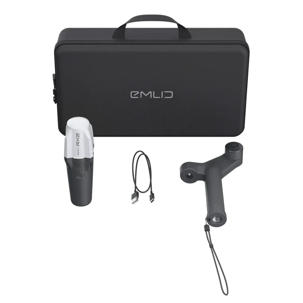
Emlid scanning kit
€2,327 excl. VAT
• Reach RX2
• Scanning handle and wrist strap
• Carrying case
3D SCANNING + SOFTWARE
Pix4D and Emlid kit
€3,900 excl. VAT
• Scanning kit with Reach RX2
• 1-year PIX4Dcatch licence
• 500 cloud credits and online training
Public prices excluding VAT as published by Emlid (October 2026), shipping not included, subject to change; project and volume pricing on request.
Centimetre accuracy in your pocket
Compact and rugged
172 × 51 × 51 mm and 280 g, IP68 (immersion up to 1.5 m for 30 minutes), from −20 to +65 °C.
Multi-band
GPS, GLONASS, Galileo, BeiDou, QZSS and NavIC on 672 channels, fix in about 5 seconds.
Tilt compensation
RTK + 2 mm + 0.3 mm/°: measure without levelling the pole.
Your GIS apps
Compatible with ArcGIS Field Maps, Survey123, QField and Mergin Maps, as well as Emlid Flow.
Georeferenced 3D scanning
Mounted on a handle with PIX4Dcatch or a similar app, it georeferences your 3D models to the centimetre.
All day long
Up to 16 h of battery life, USB-C charging. MFi certified: works with iPhone and iPad as well as Android.
GIS AND UTILITIES
Utility mapping and GIS
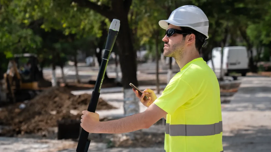
Lightweight and with no settings to tune, the RX2 turns your technicians' smartphones into centimetre-accurate survey tools, directly in your GIS.
• As-built surveys and utility detection
• Asset inventory
• Updating ArcGIS or QGIS data
SIMPLICITY
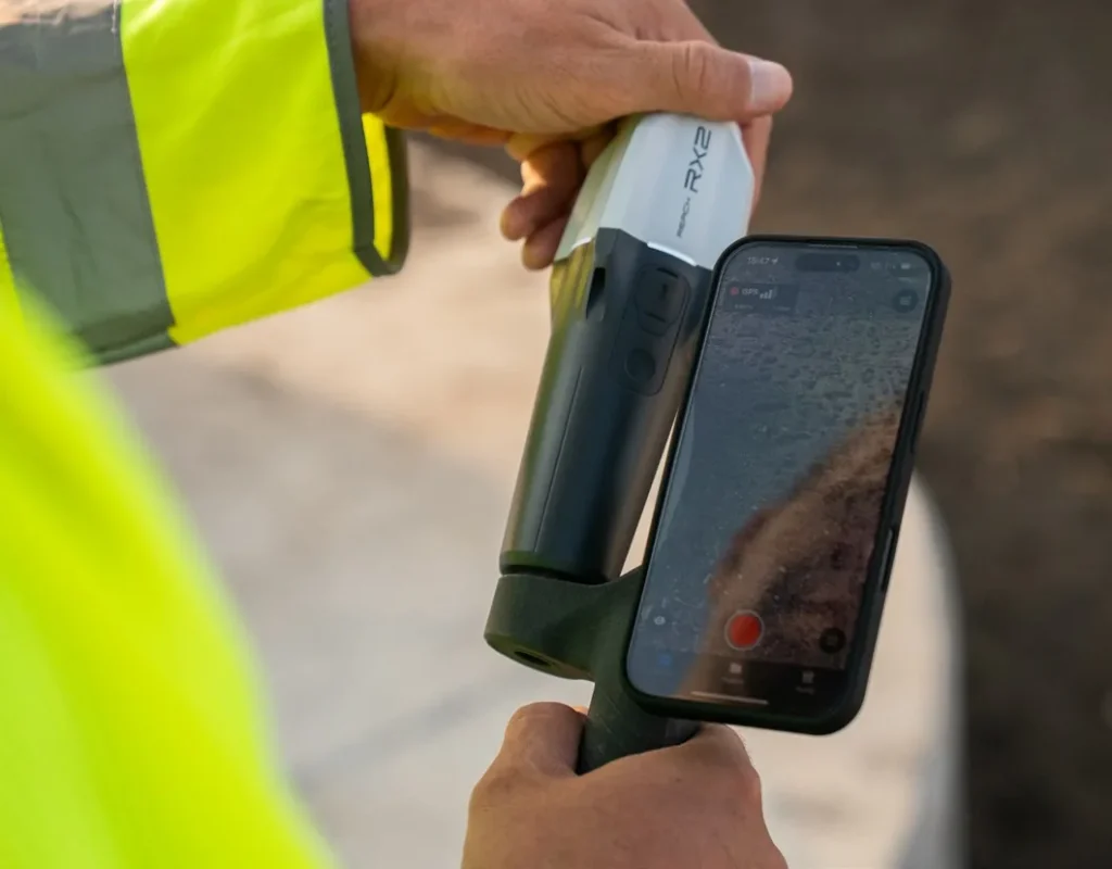
Your smartphone becomes an RTK receiver
The RX2 connects to the phone over Bluetooth, and the phone passes on the NTRIP corrections from your network. No dedicated controller is needed.
• Bluetooth connection to the smartphone
• NTRIP corrections via the phone
• 5/8" mount and quick release
DIGITISATION
Centimetre-accurate 3D scanning
With the scanning handle and PIX4Dcatch, the RX2 georeferences scans made with a smartphone. Within minutes you get measurable, shareable models.
• Trenches and utilities before backfilling
• Stockpiles and volumes
• Site condition records
Reach RX2 specifications
Dimensions
172 × 51 × 51 mm
Weight
280 g
Ruggedness
IP68 (1.5 m, 30 min) · −20 to +65 °C
GNSS
GPS, GLONASS, Galileo, BeiDou, QZSS, NavIC · 672 channels
RTK accuracy
H: 7 mm + 1 ppm · V: 14 mm + 1 ppm
Tilt
RTK + 2 mm + 0.3 mm/°
Fix and update rate
Convergence ≈ 5 s · 5 Hz
Battery life
Li-ion 7,000 mAh, 25.2 Wh · up to 16 h
Charging
USB-C 5 V / 2 A
Connectivity
Bluetooth 4.2 (BR/EDR + LE) · USB-C
Data
NTRIP corrections, RTCM3 · NMEA output
Mount and certifications
5/8"-11 UNC and quick release · FCC, CE, IC, MFi
Indicative values. Specifications provided by Emlid. Public prices excluding VAT as published by Emlid (October 2026), shipping not included, subject to change; project and volume pricing on request.

DART Solutions, your official Emlid reseller since November 2026
Buying from DART means support from choosing the equipment right through to the field, from a team based in France.
Advice and selection
We start from your sites and deliverables to choose the right receiver, the right correction source and the right accessories.
Commissioning
Base and rover set-up, NTRIP or radio corrections, coordinate system and ready-to-use Emlid Flow projects.
Training
Hands-on training in the field: surveying, stakeout, accuracy checks and data exchange with the office.
Support and after-sales
A single point of contact for your questions, your updates and liaison with Emlid for warranty claims.
Reach RX2 FAQ
Can the RX2 be used as a base?
No. The RX2 is a rover: it receives its corrections from an NTRIP network through the smartphone. For a base, you need a Reach RS4 or RS3.
How does it receive corrections?
Through the smartphone, over Bluetooth: the app (Emlid Flow or your GIS app) connects to the NTRIP network and passes the corrections to the receiver.
Does it work with an iPhone?
Yes, it is MFi certified for iPhone and iPad. It also works with Android smartphones.
Is it compatible with ArcGIS?
Yes: ArcGIS Field Maps and Survey123, as well as QField and Mergin Maps, are among the compatible apps listed by Emlid.
RX2 or RS4?
The RX2 is ideal for GIS, utilities and scanning, with a smartphone and network coverage. The RS4 adds radios, an LTE modem, base mode, post-processing and static accuracy for surveying.
Can DART train my crews?
Yes: setting up the RX2 in your GIS app, configuring corrections and training in the field.
Equipping your crews with the Reach RX2?
A fleet of GIS rovers, scanning kits or a demo: let's talk about your project.
Request a quote